A Blow-out on Team Noddy’s Noggins – R2AK 2017

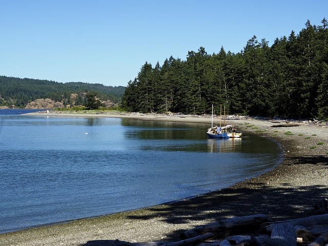
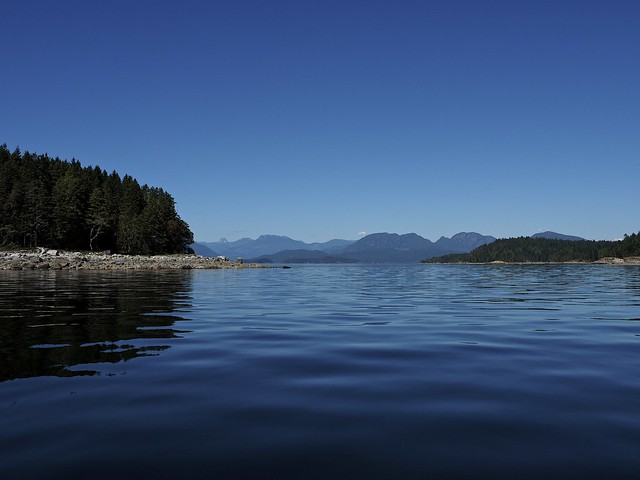
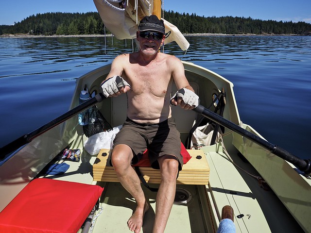
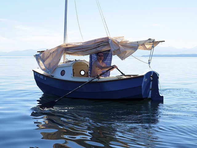
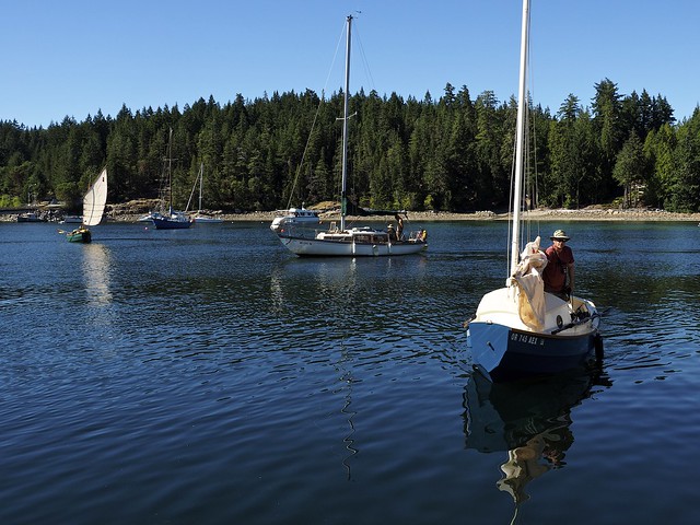
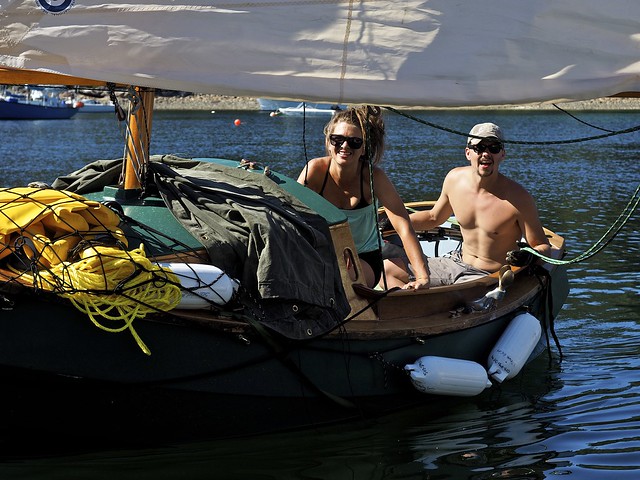
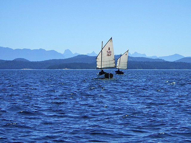
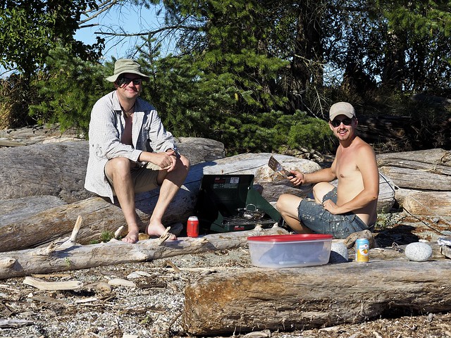
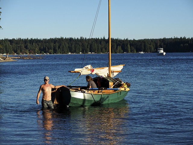
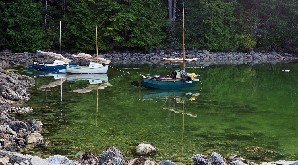
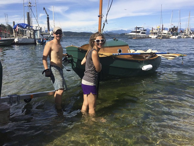
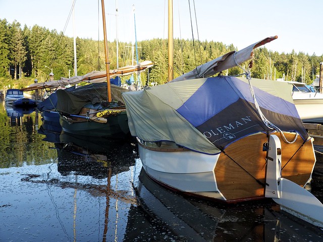
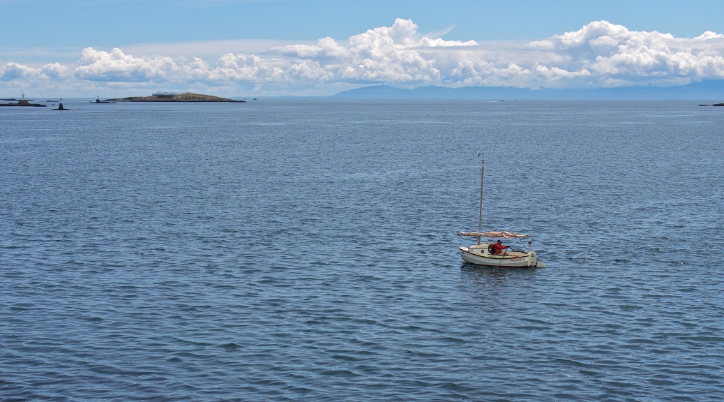
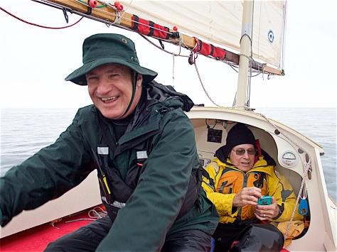
I crewed on “Team Noddy’s Noggins” for the first leg of the Race to Alaska 2017 (R2AK.com), Port Townsend to Victoria, a 40 nautical-mile diagonal crossing of the Strait of Juan de Fuca in a boat with no motor. NODDY is a 12’ SCAMP, a sister-ship to my LUNA, built and captained by Simeon Baldwin, with Denny and I as crew on this years challenge. The weather was forecast to become nasty, and it truly did.

We’re very grateful for the assistance of the Coast Guard in getting our sick crew member, Denny, to medical attention! And, I’m very pleased that the boat could handle the conditions, as much as it was compromised with a flooded buoyancy chamber and about 50 gallons of water on board. At no time did I lack confidence of our making it, but we were worried about Denny’s health.

A deep learning experience.


M6085032
Aboard Noddy: Denny at the oars, and Simeon checking the race tracker

What follows is a brief recounting of the voyage, captured in a series of text messages I sent to my SCAMP-building colleagues, Keith and Derek, the next day.

June 9, 8:07am- (the morning after):
–Tough day, once the westerlies filled in. Rowed halfway, then beat into 35kts+ and washing machine seas for way too many hours. Denny got really sick, Noddy sprung a leak (Whaler pump diaphragm or plumbing failure?). Called for assistance when we realized how bad Denny was getting, he’s fine now, I’m going to sleep for a few more hours….

Keith 8:09am-
—Gulp. Sounds like an adventure. Glad you are safe!

Derek 9:20am-
—Damn! Epic.
You’re a rock solid salt.
I was watching the tracker last night at 10pm. You were doing 4.4 knots.
Damn pump.

June 10, 6:28am- (after spending the afternoon cleaning up Noddy, and then another 12 hours of sleep)
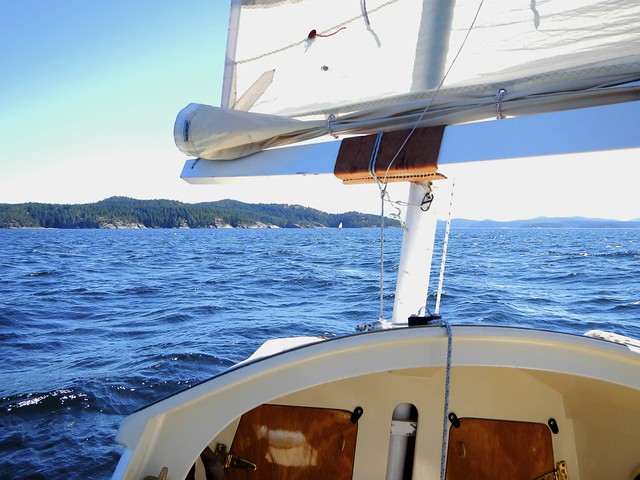
–It was amazing how many waves came in over the windward combing. I’d get us on a good angle to quarter them and take a few very smoothly, then the next one would slew us around to beam-on, and… many times I was lucky and got her head back up, but many times the next wave slopped a gallon or 5 over the (windward) side. A lot of them were breaking, but we managed to squirt through them to tackle the next.

Learned a lot, that day!

Derek 6:38am-
—Dang!
Is that why the whale gusher leaked? Because you two were using it a lot ?

–Not sure, but we couldn’t really bail with all that wind and 1 guy incapacitated. 3 fresh fit guys with a clean sole and cockpit could have handled the dewatering with a good bailer, I bet, but Noddy had a lot of shit in the bilge, and us old guys aren’t as nimble as needed to move any water between the gusts and the short lulls in the troughs.

So, a pump handled from high-side forward is the only way we could’ve been kept light enough to negotiate through that shit in order to claw to weather any more than we managed.

Derek 6:58am-
—Heavy !

–As it was, we parked once to go to 3rd reef, and pumped out (I think we only dipped the leeward rail twice, not a lot of water on board at that time), and lost at least two miles against the current and wind. The next time we looked in the starboard bench locker we found it full to the top. Simeon says he could see air bubbles coming out around the diaphragm when he was pumping, so maybe the water was going through a split in the diaphragm? That starboard locker/buoyancy tank was under water pressure from both above and below for a long time, and something failed us. The pump exit is in the centreboard case (inside the starboard locker), maybe it was backing up though there, but why into the locker? It had to be a plumbing leak, a split hose, inside that locker. Or, did it all come in through the “watertight” hatch in the seat?

We were on that first port tack for about 2 hours, with only the 2nd reef in, but kept getting headed by the current up Haro strait, so tacked to starboard and fought for half an hour with no movement over the ground. Tired of getting beat up for nothing we decided to park and go to third reef.

That put us a lot closer to San Juan Island, a lee shore, so back onto port for another two hours, we managed to claw to the western third of Haro, near Darcy Island. We had no charts on board for this far north! Our i-devices didn’t work with wet hands, and the GPS is mounted down on the forward bulkhead under the cuddy. We’re all on the windward rail, Simeon holding Denny up, and I’m on helm. I thought Sidney might be a good backup bolt hole, but there’s a marker in the middle of that gap ahead, off our starboard bow about 15 degrees, and I don’t know if it’s a reef or what!

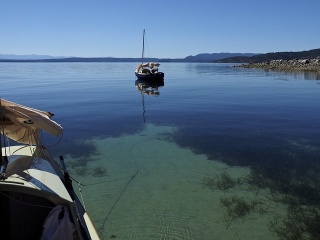
So, up near Darcy, no charts, and the wind eases, a lot! Yay! We bail and pump, lay Denny down under the cuddy, and decide to head to Victoria (!). Onto starboard tack, with the sheet eased a bit.

That lasted about ten minutes… the breeze hits back on, full force! And the boat is a dog, I fight to get her head up, beam seas wash over, it gets harder to envision making it through the pass north of Discovery/Chatham Islands, and Denny is not looking good. We fight our way through every wave, there’s some shoals in there that made them even more crazy, now they’re all breaking, about the same height as Noddy’s length, very close together.

Derek 7:40-
—11 foot waves.
Breaking!!!?
Shit. You might as well be cruising with Howard in Tierra del Fuego

— I learn to steer with the sheet, ease to point up, harden to fall off, but no way will it go above a close reach, we just fall off the back of the next wave and I get her back to a close reach…

Another shoaling set, and fucking prawn traps!! A whole line of them, right on our course, talk about ramping up the challenge!! Dodging driftwood, big logs, and now prawn traps, wallowing like a drunk, we make it through that shoal, too. Maybe two thirds the way to that point above Discovery (10 Mile Point) we get out of the shoals into more regular 4 to 6’ seas, but I can’t get to weather enough to make it above the island, so we’re talking about where we can anchor or beach her inside all those rocks…. as we get closer the wind eases, still can’t point, obvious now that I was fighting current, but at the time I was just frustrated and a bit confused!

Keith 8:04am-
Just got to Derek’s. Holy crap Dale, what an ordeal!!!

–Wind now really dropping, can’t make it to the island, getting pushed south, six or eight inches of water above the floorboards, Denny shaking real bad. Simeon makes the call. No way we can warm him up at this time, and his time is now. We’re hours away from landing anywhere… now it’s about dead calm, very rough water, and we get called back, they have visual, and then the 47′ foot CG boat roars into position to take Denny aboard. A SARS rib rolls up too, the big boat aborts (too rough) and we get Denny onto the rib, they take him over to the cutter, and the big boat heads for Oak Bay harbour at full speed.

The rib has a gas engined pump, we get most of the big water out of Noddy, and rig a tow line. We’re now a mile or two south of Discovery, at 4.5 kts it takes about an hour to get to Oak Bay, we tie up, get our passports, get a ride downtown to Simeon’s hotel where his car was parked (by Melissa earlier that day). Denny was taken to the hospital, we go there, he gets checked out, we leave with him at 2am, they drop me at my sisters, I hit the sack at 2:20, just over 24 hours since the alarm woke us at Simeon’s house in Port Ludlow.

–Sorry, I’ve screwed up some of the sequence in the story. I happened to be on helm when the Westerly hit us about 1:30 or 2pm, we were on port tack in the middle of the straight, Victoria in sight about 10 miles ahead, easily made on that tack. We thought. We were still on port tack several hours later, but had been headed by the current, and now in the middle of Haro Strait. Tried a starboard tack, made no progress at all, parked for setting 3rd reef, back on port tack at 4pm to claw our way off San Juan shore. All the way to Darcy, wind died at 5:40pm, starboard and bear away to try for the pass between 10 Mile Point and Discovery/Chatham. We get Denny down into the cuddy. Wind back on. Tried a port tack for a few minutes, but that flooded tank wanted to put the leeward rail under, so back onto starboard. Beam seas, breaking over our windward combing. Couldn’t get back up to weather, too much water on board. Can’t make the pass, wind starts easing, we shake out the 3rd reef, can’t even make the closest of the Chatham Islands. Called race command about 7:45. Landed Oak Bay Marina 10:30pm. What a day!

Keith 8:58am-
—How did the rest of the fleet do? Were you all alone in this trajectory?

–A lot of others got sucked up Haro, too. Hodges capsized and was towed to Friday Harbour, Ryan on Nomadica had about the same course as us and landed in Victoria at 2am, but he’s got a sliding seat in his Windrider 17, so he could row a lot faster than us once the wind died. We saw others in Haro, too, a couple of multihulls were with us at the VD cardinal buoy for a few hours, making no better progress, but they disappeared when we parked to reef.

June 10, 3:44pm-
—Recovered Noddy at the ramp at Cattle point a few hours ago. I’m now on the bus out to the ferry to Vancouver. Denny is feeling pretty good, they’re staying one more night at their hotel… I’m homeward bound.

Now that a bit of time has passed, I’m getting clearer on some of the issues that have been rattling me. It was predicted to be a decent SE for the morning, with an ebb tide, but that breeze never showed. So, we rowed with the current, making fairly good progress. We all had drysuits on, but Simeon and I had our tops open, Denny’s didn’t have that option. It’s likely he was pretty sweaty inside that rubber bag. Before I zipped mine up, I stripped to the waist and put a clean marino layer next my skin, then added three more layers on top. Denny didn’t change, got cold very quickly, and once the Westerly hit he went downhill pretty bad. Look after your crew-mates, make sure they’re wearing the right stuff and keeping warm!

Simeon has emailed me, the pump diaphragm was split, he’s installed a new one.
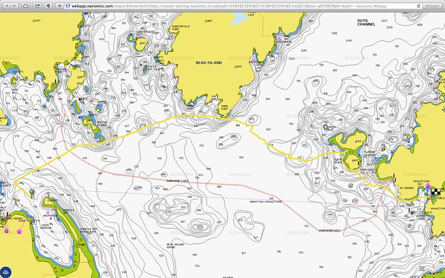
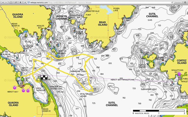
Navionics track -Noddy R2AK17

Navionics Track
Start Time: 06/08/2017 05:18 AM
End Time: 06/08/2017 10:39 PM
Total Time: 17H 11M
Distance: 59.73 NM
Average Speed: 3.50 kts
Max Speed: 8.69 kts

A bloody long row — Discovery Islands, Day 3

Sunday July 19: day 3 of our voyage, sunny and even hotter, but eventually successful!

Once again, our objective was Cortez Island across Sutil Channel. The forecast was also a repeat, 10 to 15 Kts of wind out of the northwest, supposedly with an ebb (northerly flow) until 14:40. After our unsuccessful attempt to cross the day before, we had a much clearer picture of the challenge, and a revised strategy. We’ll set out a bit earlier, and if and when the wind dies (the northwester blocked by Read Island), we’ll get out the oars and row around Viner Point and hopefully into clear air beyond. And, armed with our knowledge of the back-eddy south of Read, we’ll not let ourselves be swept south like we did on our previous, innocent attack.


our anchorage in Drew Harbour, inside Rebecca Spit


the view from Rebecca Spit in the morning, our crossing beckons

The day broke warm and clear, we brewed coffee and breakfasted onboard, used the park facilities on the Spit, and stowed the clothesline and ground tackle. We didn’t manage to get off any earlier (best laid plans awry already), we left the beach just after 10:00. The breeze freshened and we made good time beating out to the Bretons, bearing off at 11:20 to reach across Hoskyn Channel.


crossing Hoskyn Channel, once again


closing on Viner Point

As we approached the wind shadow of Read Island the pressure slowly eased, just as expected, although it did carry us just past Viner Point this time. At noon, half a mile east of the point and 4 NM into the crossing, the breeze disappeared completely.

Oars out, sail down, foils up, 1.5 NM to the Subtle Islands, the sea is a mirror, and man it’s hot! Chris took a spell on the oars, we sipped water every 10 or 20 strokes, the temp climbed and the world was in slow motion.

“Are you sure we’re moving? and not being drawn south?”

“Yes, it’s ok, watch that point against the far island, see it slide away ever so slowly?. And, according to Navionics, we’re holding our course at 1.3 Kts over the ground.” “What about now?” “Yes, still moving, our ranges are all good, damn it’s hot!”

We closed on the indent between the Subtles, and in crystal waters spied sand between the thick eelgrass of the cove. Selecting a clear spot we dropped our hook into a billow of white sand in about 3 feet of water, I stripped and jumped in, icy cold bone-jarring relief. Slowly cooling my core and strolling waist-deep around our little boat it felt like I was in paradise. Keith dropped anchor and swam, we chatted, set up some towels for shade, ate lunch, and took in our surroundings. We have crossed! New worlds await!


a lunch stop and swim in the Subtle Islands

The Subtle Islands are privately held, with a man-made causeway connecting the two Islands across the shallows separating them. Small 4-wheelers with uniformed staff and luggage-piled trailers zoomed back and forth across the causeway, guests arriving? departing? chambermaids and gardeners? Somewhat surreal! So much for our paradise, someone already owns it! (And, it’s said they’re not friendly. Lucky they were a bit too far away to see we’re naked. We hope…)

Another unexpected phenomena, cell phones that have been silently sleeping while in the bays suddenly spring to life when you’re in the big channels. Distant towers provide excellent coverage in the middle of Sutil, and texts arrived while we rested and ate: ding ding! Chris phoned home, and then her brother on Cortez to arrange a rendezvous.

“We’ll be coming in at Whaletown, but not sure when. It’s a bit of a row yet, and very hot!”


looking north, behind Subtle Islands, through Plunger Passage and up Sutil Channel

Another 1.5 NM to the entrance of Whaletown Bay to the south, and no sign of Derek and Lacy. We horizoned them by oar when we left Viner, “Let’s just hope they’re working their way across, and get going.” The heat had set a haze across the Channel, no sails in site, and once round the point our feelings of vastness and wildness and wonder returned. Bending on the sticks became rhythmic, I discarded my PFD and shirt for ventilation, my skin became wet and cool, I gained boat length after boat length, I settled into a joy of work and motion. It seemed to go forever, and I didn’t mind at all. Wow, it’s hot…


no wind meant many miles of rowing on the hottest day of our voyage


shade is hard to find on a little boat at sea

About halfway down, the radio crackled “Is that you guys along the shore?” A small spec of dark crystallized from the blue, and LIBERTY appeared slowly, oars flashing. The Pirates are together again!


Chris is relieved to know where LIBERTY is, and to be near landfall

Then, a kayaker paddled alongside to chat, and then, a big motor cruiser called over, “that’s the way to travel!” and then a little tickle of air, and hey, we’re at the entrance, and hey, we’re sailing!! Not a breath of wind in every direction except in here, and we’re heeled over and hauling ass into harbour like it belongs to us. We all do donuts of glee, 3 little marauders, bluffing our way into the bay.


ZEPHYR about to dock, and LIBERTY 53 close behind


happy scampers all!

We commandeer the Government Wharf, claiming land as we see, and Chris’ brother strolls down the gangplank with a supply of the Coldest Beer To Be Had, and a slab of the creamiest cold-smoked tuna To Be Seen. We be wharf rats, hiding beneath the gangway from the heat, our feet in water so clear, so cool, a breeze through the oily scented piles… Stoves set up, supper shared, sailing stories and rowing tales told, sun was dipping quickly now…


under the wharf


the Whaletown post office serves all residents of Cortez Island


Cortez Island Public Library, open on Fridays


Library hours: Friday 10:00 to 3:30


evening sail in Whaletown Bay

Anchored off, in the shallows behind the wharf up against the trees, we slept so soundly we must’ve been smiling, all night the milky way above hardly seen through such tightly closed and slightly burnt eyes.


we anchored in the shallows of the bay behind the gov’y dock

Some lessons learned about rowing LUNA:

  1. my nine-foot oars are just long enough to effectively row this boat, and I think another six inches might even be better. Of course this is a problem, the length desired does not fit in the boat’s sole of only 8’3″ long;
  2. I sit on top of the stack of sleeping thwarts, with a boat cushion too, to set me at the correct height for the oarlocks, almost 6 inches higher than the seat tops;
  3. the most important modification yet to do is add a riser for my feet, I’d say your stroke power is halved if you don’t have something to push against;
  4. breakdown oars fit, and are convenient when stored (mine fit inside the seat lockers), but not so when needed;
  5. the transition to rowing is much simpler, faster, thereby safer, if the oars are stowed in their locks, secured to the combing or gunwale;
  6. the risk of problems re-boarding over oars so stowed has yet to be fully evaluated, capsize testing required;
  7. these oars, Sawyer composite two-piece (purchased through Gig Harbor Boatworks), are very light. The shafts are perhaps about 1.5″ diameter, and the blades are an ovoid shape, with a fair amount of surface area, more like a sliding-seat oar but with a small-diameter shaft. So, when you first apply pressure, the shafts bend alarmingly, and it feels like all your effort is going to waste. However, once you get the boat moving, they seem quite responsive, not so bendy, and as time goes by you appreciate their lightness very much. The more I use them, the more I like them!
  8. ultimately (and pointed out by others more experienced than I), a SCAMP may be a better motor-and-sail boat than a sail-and-oar boat, but more testing and time is required (and very much desired!). I will resist the motor for as long as I can.


Day 3 Navionics track
Start Time: 2015-07-19, 10:14 AM
End Time: 2015-07-19, 4:42 PM
Distance: 8.1 NM
Total Time: 4H 55′
Average Speed: 1.8 kts
Max Speed: 5.1 kts

A glorious failure — Discovery Islands, Day 2

Saturday July 18: day 2 of our voyage, a very hot day, a fabulous sail, and 0 miles gained.

Our objective was Cortez Island, about 6 NM due east of Heriot Bay, across the southern end of Sutil Channel. Forecast was 10 to 15 Kts of wind out of the northwest, with an ebbing current (flowing towards the north) until 13:30, when it would turn and flush us southward at 1.5 to 2 Kts. Once crossed we’d head north to Coulter Bay or perhaps even as far as Carrington Bay, if there was enough breeze. If not enough wind to buck the current, we could bear off south to Whaletown, or one of several other havens further down the coast of Cortez. With plenty of time ahead we didn’t really care where we went, just the going was more than good enough.

Setting off was delayed a bit, I had to repair a rip in my prototype boom tent. The recycled tent-fly fabric was so degraded by sun in it’s previous life it split wide open across a stress point. Several feet of gaffers tape applied, and we left the dock at 10:00, on a sunny morning with a gently building breeze.


saying good bye to “the folks” at Heriot Bay


staying out of the way of the Heriot Bay to Whaletown ferry became an ongoing theme

Anticipating the breeze we all put a reef in at the dock, and as we beat out of Heriot Bay the promised pressure appeared, reassuring our decision. We aimed for the Breton Islands to the northeast, planning to go through them, then cross Hoskyn Channel to the southern end of Read Island which would be about halfway to Cortez. As we got into the Bretons we realized that they were blocking the wind, and, after a few tries gave up our attempt to get between them and bore off to round the southern end of the group.


LUNA and LIBERTY in the Breton Islands

Derek had by now shaken out his reef but Keith and I were still carrying ours, and looking across the whitecaps in Hoskyn, we felt comfortable with our sail area. Running along the islets at the southern tip, we cleared the lee and gained speed quickly as a group of hauled-out seals watched us fly by. Yippee! This was it! Dreams come true!

Hardening up to a beam reach once clear of the rocks, our excitement and joy notched up another level, we were rocking!


crossing Hoskyn Channel

Within minutes we were in the middle of the Channel and could see the pressure was easing ahead, so bore off a bit, then a bit more, and soon we were running and the wind was disappearing. Obviously being blocked by Read Island, it seemed we would have to give Viner Point, at the southern tip of Read, a wide berth to stay in some breeze. Derek was about a quarter mile behind Keith and I, and seeing our plight, bore off earlier to round further south of us.

At 12:02, half a mile southwest of Viner Point, the wind died.

Shake out that reef and shift to light air tactics — work crew positioning for boat speed, ease the outhaul a bit more, play the shifts and wind lines, watch for ripples, all good fun. Frustrating, though, not being able to make trees on Viner, in fact, it’s not getting any closer… but there’s a line just over there… a wee bit more… damn! now it’s behind us, oh, here it comes…

At 13:50, after almost two hours of chasing little puffs, Chris says

“I’ve had enough of this shit! Look, we can hardly even see Viner now, we’re so far away. We’re just getting further and further, we’re way out in the middle, and I don’t like this!! I don’t want to go to Comox, and that’s where we’re headed…”

I pull out the Navionics track on my phone, and sure enough, we’re now 1.73 NM south of Viner Point.


Day 2 Navionics track

Although we were always pointing towards Cortez, and it felt like we had boat speed, we’ve actually been dragged south all this time. Did the current turn to flood early? Were we in a massive back eddy? We shouldn’t be here!

“Right, we’re rowing.”

I deployed the oars, and Chris got on the radio. Derek and Lacy were a lot further south than us, a little dot on the horizon! Chris outlined our decision to row, and urged them to do the same. Keith was right behind us. We head northwest, half an hour of pulling took us a mile closer to the Bretons, and, all of a sudden, we were out of the wind shadow of Read. We hoisted sail and beat into that familiar 15 Kts of breeze coming out of Hoskin Channel. Overpowered, we soldiered on, not willing to give any northing away, now that we were moving. Another half an hour and we were very happily well west of the Bretons, and decided to bear away and run down into Drew Harbour for the night. We hit 5.6 kts as we eased off our heading, and we were soon on the beach inside Rebecca Spit. Landed at 15:50. It took Derek about an hour longer, short-tacking up the shore of Quadra, staying out of the current.


LIBERTY beating up the shore


setting up a clothesline anchor in Drew Harbour


dinner on the beach of Rebecca Spit

Dinner on the beach less than a mile from where we had set out in the morning, lots of laughs, decompression, and planning our second attack of the crossing. We slept on a clothesline anchor, Keith on the beach, and Derek and Lacy anchored off after a sunset sail around the bay.


Derek and Lacy head off for an evening sail


kayakers glide past our anchorage

A few more lessons learned:

  1. if you’re going to go to the effort of creating a tent, you might as well buy decent fabric (this is applicable to many other tasks, projects and builds!);
  2. when navigating new waters, don’t entirely rely on tide tables to predict currents, local anomalies such as headlands and bottom contours can create deviations in strength and direction;
  3. sailing directions and cruising guides are written for large vessels, touring in a dinghy with no engine is quite different, requiring information not covered in published guides (we knew this, but it’s worthwhile restating). Kayaking guides could be more valuable, but their concerns are different, too, and I couldn’t find anything covering this area with any detail;
  4. if you’re employing an electronic navigational aid, you should look at it more often when you don’t have much wind;
  5. listen to your crew, and even more important, your significant other. Check your assumptions, ask for other opinions, talk to your sister ships and sailing buddies, that’s what the radio is for.


Read Island at centre, and Cortez Island to the right (almost due east): our goal once again!

Navionics Track Stats:
Start Time: 2015-07-18, 10:00 AM
End Time: 2015-07-18, 3:50 PM
Distance: 9.3 NM
Total Time: 5H 50′
Average Speed: 1.6 kts
Max Speed: 5.6 kts

Liberty 53, Luna, and Zephyr: Scamps cruise the Discovery Islands

Three SCAMPs, eight nights aboard, seventy nautical miles travelled by sail and oar.

The guys first met at Scamp Camp #1, in Port Townsend WA, in the summer of 2012, where they learned how to build their 11’11” SCAMP sailing dinghies, were dubbed the Pirate Team, and dreamed of sailing together in the Salish Sea. Keith finished ZEPHYR in 2013, and we reconvened in PT for her launch, I finished LUNA in 2014 and the team came to Vancouver for her first splash, and Derek completed LIBERTY 53 a week before for our long-planned cruise this summer.

Keith, and Derek with his lovely lady Lacy, trailered their boats from Oregon to Vancouver on Thursday and the five of us, including my (filleting queen) Chris, set off the next morning for an excellent adventure.

Friday July 17 — Day 1 was a long drive from Vancouver to Quadra Island, 2 ferry rides, 3 boat launchings in Heriot Bay, parking and securing our trailers and tow vehicles, dinner for 9 with friends and family, and bedding down on the dinghy dock.

Ground support at our launch and retrieval location was invaluable. My mom and dad (Fred and Liz) came for the launch, joining our convoy for the final stage from Campbell River to Quadra Island. They helped get the boats in the water, arranged tie-up at the Heriot Bay Inn dinghy dock, had dinner with us on the deck, and stayed overnight in the Inn. And, our very dear friends Rob and Heather (Quadra residents) did ground work reconnaissance, scouting boat ramps and parking for the tow vehicles, and booking dinner at the Inn. We all had a fabulous send-off meal, a few laughs and good fun on the deck overlooking our cruising waters.

An exciting day, but somewhat tempered by the anticipation of the voyage ahead.


Derek and Lacy launching LIBERTY 53 in Heriot Bay, Quadra Island


Heriot Bay Inn


red sky at night…


morning on the dinghy dock

Several lessons learned:

  1. convoying is a communications nightmare when members cross international borders and cellular packages restrict usage (I can see the attraction of CB radio for land travel);
  2. if at all possible, ferry bookings should be made months earlier;
  3. ground support in a remote location is a rare treat;
  4. when sleeping on an open boat at a marina you should not tie up under a lamp pole;
  5. and, you should check to see if there’s a rock band playing the evening you decide to stay at the dinghy dock! No worries, with all the excitement and a few cocktails, we all slept like babies. It was a good band.

( small adventures in a very small boat )