Saturday July 18: day 2 of our voyage, a very hot day, a fabulous sail, and 0 miles gained.
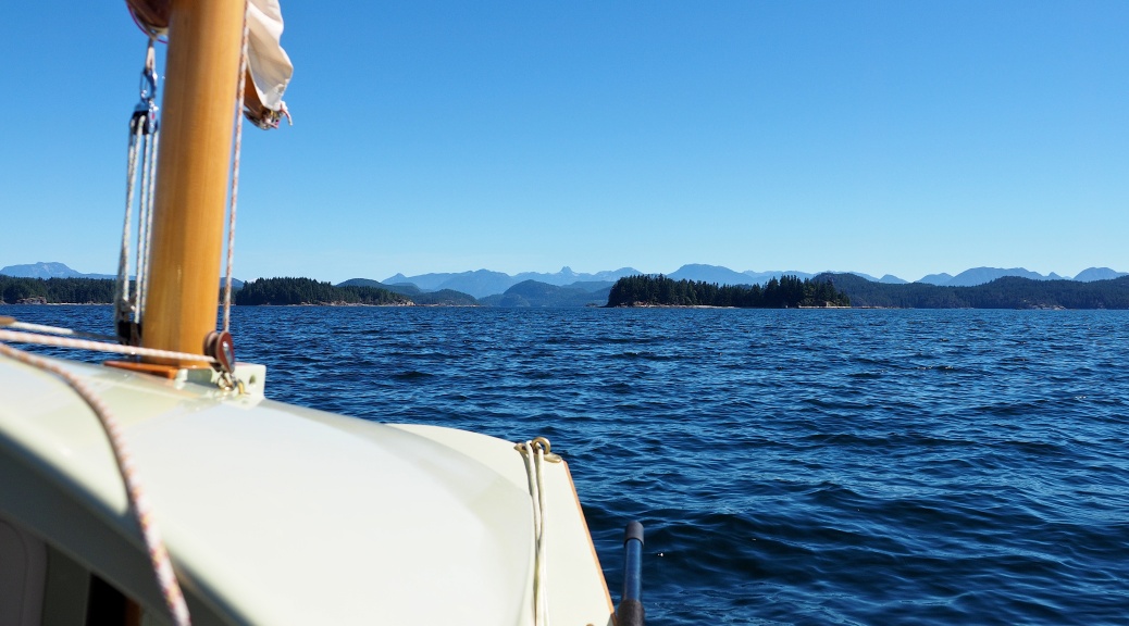
Our objective was Cortez Island, about 6 NM due east of Heriot Bay, across the southern end of Sutil Channel. Forecast was 10 to 15 Kts of wind out of the northwest, with an ebbing current (flowing towards the north) until 13:30, when it would turn and flush us southward at 1.5 to 2 Kts. Once crossed we’d head north to Coulter Bay or perhaps even as far as Carrington Bay, if there was enough breeze. If not enough wind to buck the current, we could bear off south to Whaletown, or one of several other havens further down the coast of Cortez. With plenty of time ahead we didn’t really care where we went, just the going was more than good enough.
Setting off was delayed a bit, I had to repair a rip in my prototype boom tent. The recycled tent-fly fabric was so degraded by sun in it’s previous life it split wide open across a stress point. Several feet of gaffers tape applied, and we left the dock at 10:00, on a sunny morning with a gently building breeze.
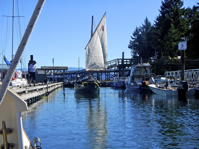
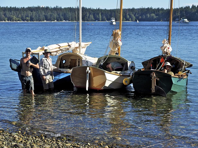
saying good bye to “the folks” at Heriot Bay
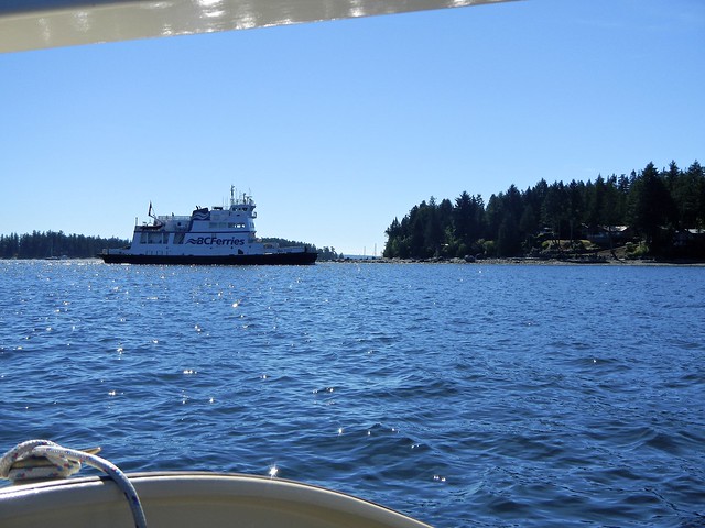
staying out of the way of the Heriot Bay to Whaletown ferry became an ongoing theme
Anticipating the breeze we all put a reef in at the dock, and as we beat out of Heriot Bay the promised pressure appeared, reassuring our decision. We aimed for the Breton Islands to the northeast, planning to go through them, then cross Hoskyn Channel to the southern end of Read Island which would be about halfway to Cortez. As we got into the Bretons we realized that they were blocking the wind, and, after a few tries gave up our attempt to get between them and bore off to round the southern end of the group.
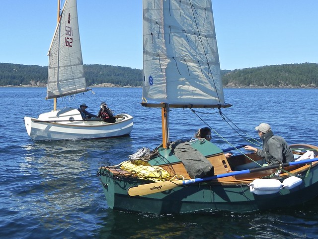
LUNA and LIBERTY in the Breton Islands
Derek had by now shaken out his reef but Keith and I were still carrying ours, and looking across the whitecaps in Hoskyn, we felt comfortable with our sail area. Running along the islets at the southern tip, we cleared the lee and gained speed quickly as a group of hauled-out seals watched us fly by. Yippee! This was it! Dreams come true!
Hardening up to a beam reach once clear of the rocks, our excitement and joy notched up another level, we were rocking!
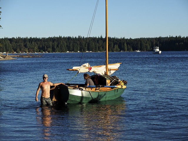
Within minutes we were in the middle of the Channel and could see the pressure was easing ahead, so bore off a bit, then a bit more, and soon we were running and the wind was disappearing. Obviously being blocked by Read Island, it seemed we would have to give Viner Point, at the southern tip of Read, a wide berth to stay in some breeze. Derek was about a quarter mile behind Keith and I, and seeing our plight, bore off earlier to round further south of us.
At 12:02, half a mile southwest of Viner Point, the wind died.
Shake out that reef and shift to light air tactics — work crew positioning for boat speed, ease the outhaul a bit more, play the shifts and wind lines, watch for ripples, all good fun. Frustrating, though, not being able to make trees on Viner, in fact, it’s not getting any closer… but there’s a line just over there… a wee bit more… damn! now it’s behind us, oh, here it comes…
At 13:50, after almost two hours of chasing little puffs, Chris says
“I’ve had enough of this shit! Look, we can hardly even see Viner now, we’re so far away. We’re just getting further and further, we’re way out in the middle, and I don’t like this!! I don’t want to go to Comox, and that’s where we’re headed…”
I pull out the Navionics track on my phone, and sure enough, we’re now 1.73 NM south of Viner Point.
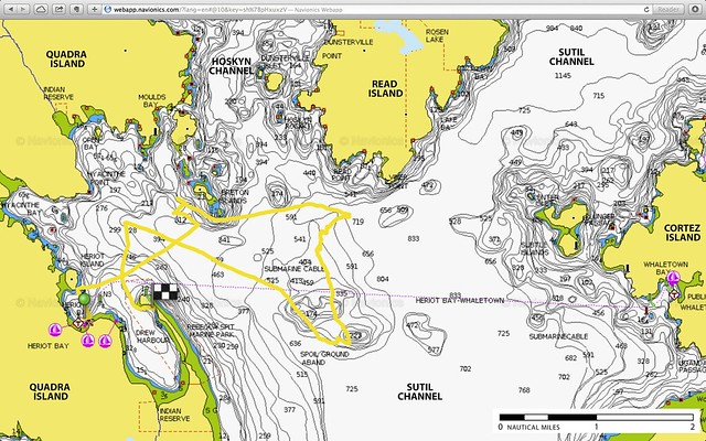
Although we were always pointing towards Cortez, and it felt like we had boat speed, we’ve actually been dragged south all this time. Did the current turn to flood early? Were we in a massive back eddy? We shouldn’t be here!
“Right, we’re rowing.”
I deployed the oars, and Chris got on the radio. Derek and Lacy were a lot further south than us, a little dot on the horizon! Chris outlined our decision to row, and urged them to do the same. Keith was right behind us. We head northwest, half an hour of pulling took us a mile closer to the Bretons, and, all of a sudden, we were out of the wind shadow of Read. We hoisted sail and beat into that familiar 15 Kts of breeze coming out of Hoskin Channel. Overpowered, we soldiered on, not willing to give any northing away, now that we were moving. Another half an hour and we were very happily well west of the Bretons, and decided to bear away and run down into Drew Harbour for the night. We hit 5.6 kts as we eased off our heading, and we were soon on the beach inside Rebecca Spit. Landed at 15:50. It took Derek about an hour longer, short-tacking up the shore of Quadra, staying out of the current.
setting up a clothesline anchor in Drew Harbour
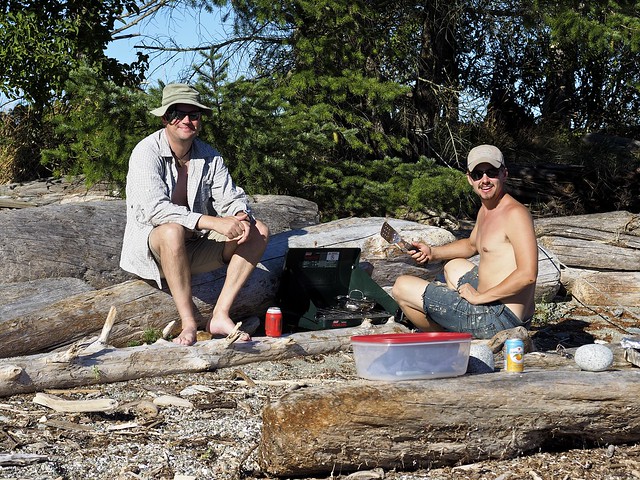
dinner on the beach of Rebecca Spit
Dinner on the beach less than a mile from where we had set out in the morning, lots of laughs, decompression, and planning our second attack of the crossing. We slept on a clothesline anchor, Keith on the beach, and Derek and Lacy anchored off after a sunset sail around the bay.
Derek and Lacy head off for an evening sail
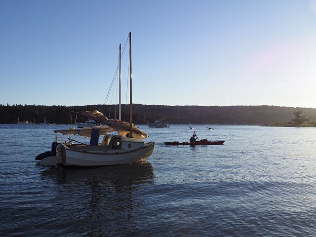
kayakers glide past our anchorage
A few more lessons learned:
- if you’re going to go to the effort of creating a tent, you might as well buy decent fabric (this is applicable to many other tasks, projects and builds!);
- when navigating new waters, don’t entirely rely on tide tables to predict currents, local anomalies such as headlands and bottom contours can create deviations in strength and direction;
- sailing directions and cruising guides are written for large vessels, touring in a dinghy with no engine is quite different, requiring information not covered in published guides (we knew this, but it’s worthwhile restating). Kayaking guides could be more valuable, but their concerns are different, too, and I couldn’t find anything covering this area with any detail;
- if you’re employing an electronic navigational aid, you should look at it more often when you don’t have much wind;
- listen to your crew, and even more important, your significant other. Check your assumptions, ask for other opinions, talk to your sister ships and sailing buddies, that’s what the radio is for.
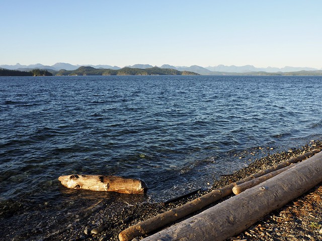
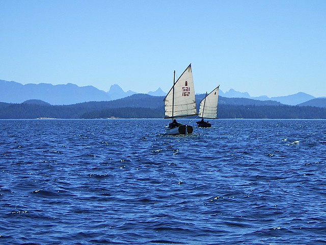
Read Island at centre, and Cortez Island to the right (almost due east): our goal once again!
Navionics Track Stats:
Start Time: 2015-07-18, 10:00 AM
End Time: 2015-07-18, 3:50 PM
Distance: 9.3 NM
Total Time: 5H 50′
Average Speed: 1.6 kts
Max Speed: 5.6 kts

I’m loving your blog of the voyage. Keep it up!
Simeon & Noddy
LikeLiked by 1 person
Glad to hear from you Simeon! I’ll try to condense a bit, I think I’m going to run out of patience! All good fun, though! Thanks for the encouragement…
LikeLike
Was Keith a solo sailor for the trip? I wonder if you were able to see any SCAMP performance differences when sailing together. I really doubt it!
LikeLiked by 1 person
Rowing performance: either he’s a lot stronger than me (he’s definitely younger and fitter), or, the weight of 2-up really makes a difference. Otherwise, not much to notice. He put an extra reef in his sail once or twice, but only for very short periods, soon shaking out the extra and carrying the same canvas as us.
LikeLiked by 1 person
Hi Dale
Really enjoying your blog and great photos. Super to see more small boats doing great things around here!
We launched our Chebacco 20 in 2002 after a six years build and sail mostly in local waters (Howe Sound, Indian Arm, San Juans). Live in Port Moody but currently keeping Bluster at our Gibsons cottage.
Here is my blog I keep:
http://chebaccowanderings.blogspot.ca/
I am very interested in SCAMPs I am starting a slow itch to get building again. Checked a couple out at the PT Palooza last year.
If you are ever planning to get out on the water and would not mind having some live ballast I would love to tag along for a bit. Maybe meet up on the water some day although Luna will make Bluster look like an ocean liner.
Thanks for sharing!
Randy Wheating
randy.wheating@gmail.com
LikeLiked by 1 person
Hi Randy,
Great to hear from you, it’s a pleasure to meet you on the interwebs! I’d love to have you aboard Luna, and also do some sailing with Buster. I had a quick peek at your blog, she (or, perhaps with that name, she’s a he!) looks like a beauty, though it might be a bit challenging for a little Scamp to keep up with her! I missed the Palooza this year, as we were in the Discovery Islands at that time. But I will be going down to PT for the Wooden Boat Fest next week. Perhaps you’ll be there?
Cheers,
Dale
LikeLike
Oh my goodness, I’m sorry, just re-reading, she’s “Bluster”. A very fine name for a beautiful little ship!
LikeLike
I will not be getting to PT WBF this year as I have slated that weekend to work on Bluster’s stuck centreboard. After 13 years of no trouble at all last time out it refused to be lowered. Hoping it is just sometime obvious and easily resolved.
Trying get at least one overnight weekend mini cruise before winter hits and thinking about sailing from Gibsons (where I currrently store Bluster) to Halket Bay on Gambier, spend the night and return to Gibsons the next day. If interested in rendezvousing for the day or overnighting let me know. A friend once launched at Sunset marina which is just off Gambier. Gibsons has an excellent ramp but involves ferry costs. Have not picked weekend yet and still depends on weather and centreboard status. Randy
LikeLiked by 1 person
Oh yes! A night or two in Halkett Bay is on my must-do list. I’ve launched several times out of Porteau Cove, and on the last visit I went around Anvil Island in a fairly strong thermal (15-20 Kts?) from the south. That trip convinced me I’m able to get to Halkett from Porteau, although it would be a good long beat in the prevailing fine-weather thermals. About 7 NM as the crow flies, then around the point and up into the bay. From Sunset Marina would be very do-able, I imagine, at about 4 NM, downwind in good weather, and upwind back to the ramp (wonder what they charge?). Perhaps later in September, early Oct?
Hope your centreboard repair goes smoothly!
LikeLike
These dates work for me Dale. I can tack an extra day onto the weekend to make it two nights. Maybe one night at Halket and one at Plumper Cove for variety.
LikeLike
Great stuff!! I’ll PM you… looking forward to meeting up with another small boat sailor!!
LikeLike